Blog Post 7
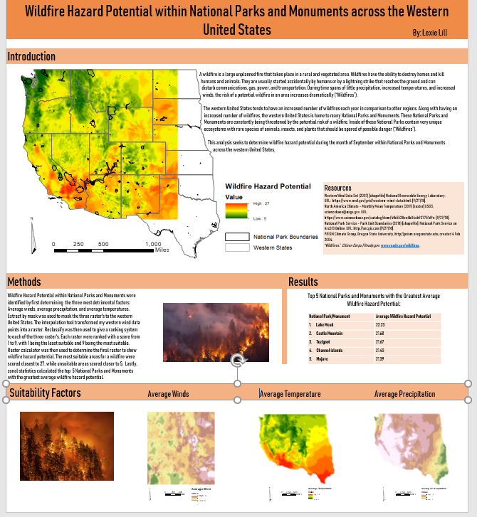
This week I finished up my final poster that I will be turning in. I decided to do an introduction, methods, results, and suitability factors section. My method section describes exactly what I did to get my wildfire hazard potential raster. My results section shows a table that I made in Microsoft word to show the top five National Parks and Monuments with the greatest average wildfire hazard potential. These National Parks and Monuments include 1. Lake Mead 2. Castle Mountain 3.Tuzigoot 4. Channel Islands 5. Mojave. The suitability factors sections shows the three rasters that I reclassified. I then added these three rasters together to get my wildfire hazard potential raster. I also decided to add in some pictures of wildfires to fill in the blank spaces to make my poster look more complete.
My last steps are to proofread my written sections and make sure that all my images and tables line up neatly and look professional. I am so happy this is finished and am proud of the work I completed. I hope that I will be able to use this poster as a tool someday to help me in job interviews and future work.
Hi Lexie, I think your poster came out really well. The color of the poster goes well with the colors of your various maps. I like that you put all your resources in one spot instead of on all the separate maps.
ReplyDelete